
Please use the map below to browse geographically and click the pins for more details.
Or, scroll down the page to see an alphabetical listing.
Route information, GPX files and Risk Assessments are for reference of volunteers and participants, and to be used during BWOAS walk and under supervision of our volunteers only. Anybody using the supplied material outside of a Monday or Wednesday BWOAS walk does so at their own risk.


🟢️ BORSDANE WOOD
from THE GERRARD ARMS, ASPULL.
https://www.facebook.com/p/The-Gerrard-Arms-Aspull-61563794470763/


⛰️ 7.7km, or 4.8 miles - 90m ascent - 2 hours.
🟢️ A VERY EASY walk with mostly FLAT, WELL SURFACED PATHS. Some areas of MUD and UNEVEN TERRAIN. Suitable for anybody with good mobility and even a basic level of fitness.
📍 The Gerrard Arms Aspull, 615 Bolton Road, WN2 1PZ - unlimited.arranges.marbles - SD627074.
🚌 There is no public transport to this location.
🚗 There is a small car park behind the pub and on-street parking around the local area. Car pooling is encouraged. Wherever you do park, please take care not to block access for local residents and businesses, ALWAYS check signage before leaving your vehicle.
🟠🟠 CHEETHAM CLOSE
from THE MASONS ARMS, EGERTON.


⛰️ 7.2km, or just over 4 miles - 200m ascent - 2 hours.
🟠🟠 An enjoyable moorland walk with with BOGGY AREAS, UNEVEN TERRAIN and one particular STEEP, STRENUOUS UPHILL PATH. Suitable for those with a moderate to high level of fitness.
📍 The Masons Arms, Blackburn Road, Egerton, BL7 9SB - bins.employ.vibes - SD710145.
🚌 There are various bus links to and from this location, including the #1 bus between Bolton, Darwen and Blackburn and the 533 which covers Bolton and Bromley Cross.
🚗 Limited on street parking is available around the venue. Car pooling is encouraged. Wherever you do park, please take care not to block access for local residents and businesses, ALWAYS check signage before leaving your vehicle.
🟠🟠 CROWTHORN CIRCULAR
from THE BLACK BULL, EDGWORTH.


⛰️ 7.2km or just over 4 miles - 200m ascent - 2 hours.
🟠🟠 Almost all of the climb is in the first 3km of the walk up towards Scholes Height. There's a gradual descent back through Crowthorn before skirting along the side of Wayoh Reservoir before heading back to the Black Dog. There may be LIVESTOCK along the route. There are also UNEVEN SURFACES and TRIP HAZARDS. Suitable for those with good fitness and previous walking experience.
📍 The Black Bull, 167-169 Bolton Rd, Edgworth, BL7 0AF - imprinted.jacuzzi.vandalism - SD738162.
🚌 Unfortunately, there is no public transport to this location.
🚗 The pub has a large car park BUT car pooling is encouraged where possible so as not to hog spaces for other customers and diners. If parking around the area, please take care not to block access for local residents and businesses, ALWAYS check signage before leaving your vehicle.
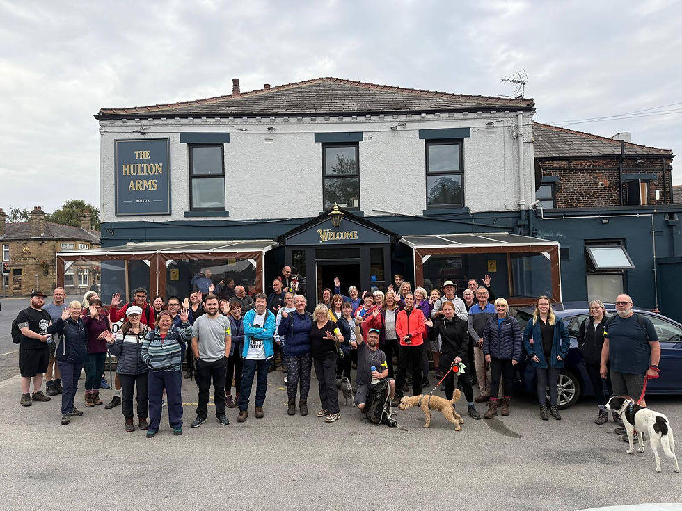
🟢 CUTACRE COUNTRY PARK
from THE HULTON ARMS, OVER HULTON.


⛰️ 7km, or just over 4 miles - 70m of ascent - 2 hours.
🟢 A VERY EASY walk with FLAT, WELL SURFACED PATHS. Some short lived UNEVEN SURFACES, MUD and a couple of BUSY ROAD CROSSINGS. Suitable for anybody with good mobility and even a basic level of fitness.
📍 The Hulton Arms, 1 Newbrook Rd, Over Hulton, Bolton BL5 1EJ - tribes.cakes.ants - SD690057.
🚍 It is possible to get the 582, 20 and 22 bus services from Bolton town centre and further afield to and from this location.
🚗 There is a modest car park available at the venue and on street parking can be found close by. If parking around the local area, please take care not to block access for local residents and businesses, ALWAYS check signage before leaving your vehicle.
🟠🟠/🔴🔴 DARWEN TOWER
from THE ROYAL ARMS, TOCKHOLES.


⛰️ 6.5km, or 4 miles - 200m of ascent - 2 hours.
🟠🟠 (in daylight) / 🔴🔴 (in darkness) - This is a MODERATELY STRENUOUS route with some VERY STEEP HILLSIDE PATHS on both ascent and descent gradients, and lots of UNEVEN TERRAIN. Suitable for those with good fitness and previous walking experience.
📍 The Royal Arms, Tockholes Rd, Ryal Fold, BB3 0PA - thrillers.symphony.paint - SD664215.
🚌 There is NO PUBLIC TRANSPORT to or from this location on Wednesday evenings.
🚗 There is plenty of free parking adjacent to the venue. Car pooling is encouraged where possible. Wherever you do park, please take care not to block access for local residents and businesses, ALWAYS check signage before leaving your vehicle.
🟢 HAIGH HALL and the LEEDS TO LIVERPOOL CANAL
from THE VICTORIA, ASPULL.


⛰️ 7km, or just 4 miles - 80m ascent - 2 hours.
🟢 A very EASY and FLAT walk with country lanes and a long section along the canal tow path. Some UNEVEN SURFACES and MUDDY WOODLAND AREAS.
📍 The Victoria Pub Aspull, Haigh Road, WN2 1RN - punk.bunny.arrow - SD607088.
🚌 It is possible to catch the 575 bus service that runs between Bolton, Horwich, Blackrod and Wigan to St David's Crescent, which is less than a five minute walk away.
🚗 CAR POOLING IS EXTREMELY ENCOURAGED as CAR PARKING IS LIMITED. There is on street parking on Haigh Road - wherever you do park, PLEASE take care not to block access for local residents and businesses, ALWAYS check signage before leaving your vehicle.
🟠🟠 HAWKSHAW CIRCULAR
from THE WAGGON AND HORSES, HAWKSHAW.


⛰️ 7km, or 4.3miles - 171m - 2 hours.
🟠🟠 This route goes past Holcombe shooting range and past the Krypton Factor assault course. Almost all of the climb is at the start of the walk, which is quite hilly. There are a few stiles, some with dog gates. We will be passing through fields where there may be livestock, so please be aware and keep dogs on a close lead. Most sections of the walk are unpaved with potential trip and slip hazards. A full safety briefing will be given at the start of the walk to reminds participants of any risks associated to this route. Suitable for those with good fitness and previous walking experience.
📍 Waggon and Horses, 360 Bolton Rd, Hawkshaw, Bury, BL8 4JL - fattening.enter.claps - SD759150.
🚌 It is possible to catch the 480 from and to Bolton, Bury and other surrounding villages. But PLEASE check timetables before travelling via www.bustimes.org
🚗 There is a small car park and plenty of free parking on the road at the side of the pub (Hawkshaw Lane). Car pooling is encouraged where possible. Wherever you do park, please take care not to block access for local residents and businesses, ALWAYS check signage before leaving your vehicle.
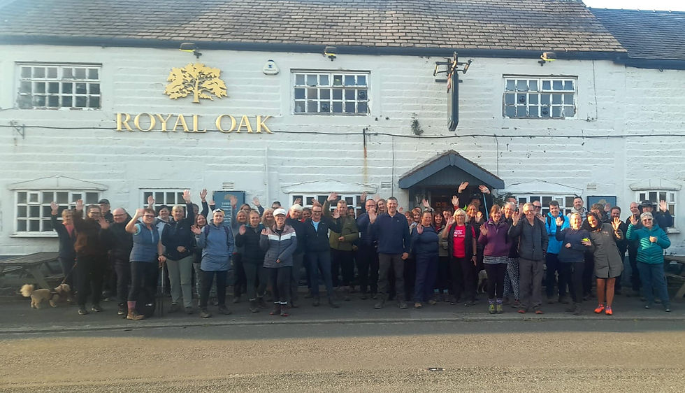
🟢 HOGHTON BOTTOMS
from THE ROYAL OAK, RILEY GREEN.


⛰️ 8km, or just under 5 miles - 110m of ascent - 2 hours.
🟢 VERY EASY and largely FLAT route with well surfaced trails and a canal tow path. Occasional ROAD CROSSINGS and a RAILWAY CROSSING. Some areas of MUD and UNEVEN SLOPES. Anybody with good mobility and even a basic level of fitness will manage this walk.
📍The Royal Oak, Blackburn Old Rd, Hoghton, PR5 0SJ - stays.almost.camcorder - SD621254.
🚌 It is possible to catch the 152 bus service to and from this location from that runs between Preston and Burnley, calling at Clayton-le-Moors, Rishton and Blackburn.
🚗 The pub has a large car park BUT car pooling is encouraged where possible so as not to hog spaces for other customers and diners. If parking around the area, please take care not to block access for local residents and businesses, ALWAYS check signage before leaving your vehicle.
🟢 LITTLE WAYOH and ENTWISTLE RESERVOIRS
from THE STRAWBURY DUCK, EDGWORTH.


⛰️ Just under 7km, or 4 miles - 80m ascent - up to 2 hours.
🟢 A largely flat and easy reservoir walk on well surfaced tracks. There WILL BE MUD! There is also one short lived but rough descent with exposed tree roots and loose gravel/earth. There is also one longer steep uphill section into Armsgrove Clough. Suitable for anybody with GOOD MOBILITY but even a basic level of fitness.
📍The Strawbury Duck, Overshores Road, Edgworth, BL7 0LU - design.incisions.slams - SD727176 (PLEASE DO NOT PARK AT THE VENUE - SEE BELOW).
🚄𝐓𝐑𝐀𝐈𝐍 𝐑𝐄𝐂𝐂𝐎𝐌𝐌𝐄𝐍𝐃𝐄𝐃! Why not consider leaving your car at home and getting the train? There are services to and from Entwistle Station connecting to Blackburn, Darwen, Bolton, Manchester and elsewhere. Please check the latest timetable information before travelling.
🚗 There is quite a large car park at the pub but there will be lots of diners attending so PLEASE DO NOT PARK HERE. Other parking is available very close by on Entwistle Hall Lane, or a 10 minute walk away at the main car park for Entwistle off Green Arms Road (BL7 0NF / crossing.nightfall.roughness). Car pooling is encouraged. Wherever you do park, please check signage before leaving your vehicle and take care not to block access for local residents and businesses.
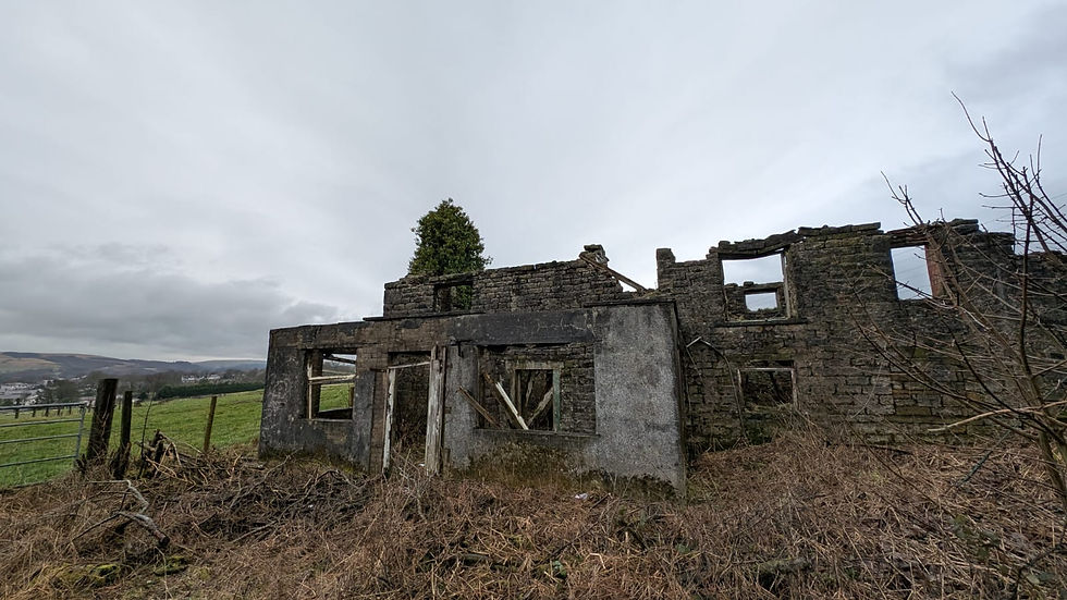
🟠🟠 LOST FARMS OF RIVINGTON LE MOORS
from LOWER HOUSE CAR PARK, RIVINGTON.


⛰️ 6km or 3.5 miles - 170m ascent - 2 hours.
ℹ️ This is an informative outing visiting various sites of ruined farms led by knowledgeable volunteer Charlene. Her ancestors actually lived and worked these farms and the stories that Charlene has to share with the group are fascinating. 𝐍𝐨𝐭 𝐭𝐨 𝐛𝐞 𝐦𝐢𝐬𝐬𝐞𝐝!
🟠🟠 A rugged moorland walk with UNEVEN and BOGGY terrain, STILES, some HILLSIDE climbs and sections of COUNTRY LANES. Suitable for those with good mobility and moderate fitness.
📍 Lower House Car Park, off Sheephouse Lane. BL6 7SD - pillow.martini.connector - SD637148.
🚌 Unfortunately, there is no public transport to this location.
🚗 There is plenty of free parking, although car pooling is still encouraged to minimise environmental impact. There are always doggers and stoners but they're no trouble.
🟢 LOSTOCK and WINGATES
from THE DUKE OF WELLINGTON, CHEW MOOR.
https://www.facebook.com/Thedukeofwelly/


⛰️ 7km, or just over 4 miles - only 25m of ascent - 2 hours.
🟢 VERY EASY and largely FLAT route with well surfaced paths and lanes. Occasional STILES, ROAD CROSSINGS and some areas of MUD. Anybody with good mobility and even a basic level of fitness will manage this walk.
🐮 The route passes Mootop Dairy where participants can pick up tasty milkshake from the self service vending machine.
📍The Duke Of Wellington, Chew Moor, Lostock, BL6 4HA - prop.frost.deflection - SD667075.
🚌 It is possible to catch the 520 bus service to and from this location from Bolton, Deane and Westhoughton.
🚗 The pub has a large car park BUT car pooling is encouraged where possible so as not to hog spaces for other customers and diners. If parking around the area, please take care not to block access for local residents and businesses, ALWAYS check signage before leaving your vehicle.
🟢 MANCHESTER, BOLTON and BURY CANAL
from THE MARKET STREET TAVERN, STONECLOUGH.www.facebook.com/p/Market-Street-Tavern-2024-61559868746477


⛰️ 7.7km, or 4.8miles - 80m ascent - 2 hours.
🟢 A very EASY and FLAT walk with some urban paths and a long section along the canal tow path. Some UNEVEN SURFACES, SLIGHT INCLINES and MUDDY WOODLAND AREAS. Anybody with good mobility and even a basic level of fitness is welcome to attend.
📍 Market Street Tavern 2024, 131 Market St, Stoneclough, M26 1HF - exit.global.dozed - SD757055.
🚍 It is possible to catch the 512 bus service to this location from Farnworth. Kearsley train station is a 20 minute walk away with regular services from Bolton and beyond.
🚗 There is VERY LIMITED PARKING around the pub on the main road. Car pooling is encouraged. Wherever you do park, please take care not to block access for local residents and businesses, ALWAYS check signage before leaving your vehicle.
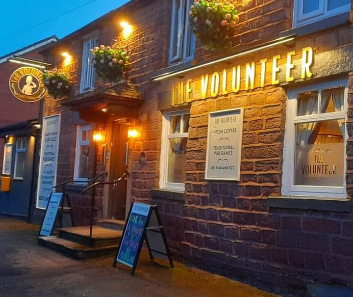
🟢 MANCHESTER, BOLTON and BURY CANAL
from THE VOLUNTEER, DARCY LEVER.
https://www.facebook.com/thevollydarcy


⛰️ 7.2km, or just over 4 miles - 90m of ascent - 2 hours.
🟢 One of our mot popular "regular" routes, which can be described as VERY EASY with mostly FLAT, WELL SURFACED PATHS. Some short lived INCLINES, UNEVEN SURFACES, MUD and a couple of BUSY ROAD CROSSINGS. Anybody with good mobility and even a basic level of fitness is welcome to attend.
📍 The Volunteer, 276 Radcliffe Rd, Darcy Lever, Bolton BL3 1RS - hang.goods.loving - SD734080.
🚍 𝐁𝐔𝐒 𝐑𝐄𝐂𝐂𝐎𝐌𝐌𝐄𝐍𝐃𝐄𝐃! It is possible to get the 511 and 544 bus services from Bolton town centre and Bury to and from this location.
🚗 There is a very small car park available at the venue and very limited on street parking can be found close by. If parking around the local area, please take care not to block access for local residents and businesses, ALWAYS check signage before leaving your vehicle.
🟢 SMITHILLS and BARROW BRIDGE
from THE FINISHERS ARMS, HEATON.
https://thefinishersarms.com/


⛰️ 7.5km or 4.5 miles - 140m ascent - 2 hours.
🟢 A very easy route with pleasant woodland and countryside trails. Occasional SLOPES and UNEVEN TERRAIN, some MUDDY AREAS, STILES and ROAD CROSSINGS. Suitable for anybody with good mobility and even a basic level of fitness.
📍 The Finishers Arms, 487 Church Rd, Bolton BL1 5RE - limp.noting.puddles - SD691106.
🚌 𝐖𝐡𝐲 𝐧𝐨𝐭 𝐆𝐄𝐓 𝐓𝐇𝐄 𝐁𝐔𝐒? This is an easy one, the 501 between Bolton and Johnson Fold stops and picks up right outside the pub. It is also possible to catch the 125 between Bolton, Horwich, Chorley and Preston with stops only a fifteen minute walk away on Chorley Old Road.
🚗 There is limited on street parking around the local area. Please take care not to block access for residents and businesses. Car pooling is encouraged to limit any impact on the neighbourhood.


⛰️ 6.5km, or 4 miles - 220m of ascent - 2 hours.
🟠🟠 (in daylight) / 🔴🔴 (in darkness) - MODERATELY STRENUOUS route with one particular STEEP AND UNEVEN HILLSIDE PATH and a SLIPPERY, GRASSY DESCENT. Other areas will be MUDDY with UNEVEN SURFACES and EXPOSED TREE ROOTS. Suitable for those with good fitness and previous walking experience.
📍 Irwell Works Brewery, Irwell Street, Ramsbottom - BL0 9YQ - showering.assurance.sourcing - SD791167.
🚌 There is NO PUBLIC TRANSPORT available from Bolton to this location. There are infrequent services between Ramsbottom and Bury but please check www.bustimes.org for details.
🚗 LIMITED PARKING around the local area, car pooling is encouraged where possible. Please take care not to block access for local residents and businesses, ALWAYS check signage before leaving your vehicle.


⛰️ Just under 7km, or 4 miles - 200m ascent - up to 2 hours.
🟠🟠 (in daylight) / 🔴🔴 (in darkness) - A STEEP and STRENUOUS hillside walk with UNEVEN TERRAIN and TOUGH SLOPES on both the ascent and descent. Suitable for those with PREVIOUS WALKING EXPERIENCE and a moderate to high level of fitness.
📍Blackedge Brewery, Hampson St, Horwich, BL6 7JH - imprinted.winning.chitchat - SD635118.
🚌 𝐁𝐔𝐒 𝐑𝐄𝐂𝐂𝐎𝐌𝐌𝐄𝐍𝐃𝐄𝐃! It is possible to catch the 125 bus to and from Bolton town centre, Adlington, Chorley and Preston. Or the 575 from Bolton town centre, Blackrod, Aspull and Wigan. PLEASE CHECK TIMETABLES BEFORE TRAVELLING.
🚗 CAR POOLING IS ADVISED as there is very limited on street parking around the local area. Wherever you do park, PLEASE take care not to block access for local residents and businesses, ALWAYS check signage before leaving your vehicle.
🟠🟠 /🔴🔴 TWO LADS
from THE BRIDGE HOTEL, HORWICH.https://www.facebook.com/thebridgehotelhorwich


⛰️ 7km, or just over 4 miles - 260m ascent - 2 hours.
🟠🟠 (in daylight) / 🔴🔴 (in darkness) A STEEP and STRENUOUS moorland walk with BOGGY AREAS, UNEVEN TERRAIN and TOUGH SLOPES on both the ascent and descent. Suitable for EXPERIENCED WALKERS ONLY with a moderate to high level of fitness.
🥤☕🧁🥮 Leonie and staff at The Pike Snack Shack usually open especially for us, which means walkers can pick up a hot drink, a pastie or cake.
📍 The Bridge Hotel, Horwich, 121 Church Street, Horwich, BL6 7BR - boats.upon.arose - SD641115.
🚌 𝐁𝐔𝐒 𝐑𝐄𝐂𝐂𝐎𝐌𝐌𝐄𝐍𝐃𝐄𝐃! There is plenty of public transport to this location, including the 125 bus from Bolton, Chorley or Preston. The 575 and 576 services between Bolton and Wigan stop about a ten minute walk from the venue.
🚗 Limited parking is available adjacent to the pub on Bridge Street. Car pooling is encouraged. Wherever you do park, please take care not to block access for local residents and businesses, ALWAYS check signage before leaving your vehicle.


⛰️ 6km, or just under 4 miles - 240m of ascent - 2 hours.
🔴🔴🔴 CHALLENGING and STRENUOUS route with STEEP HILLSIDE PATHS, UNEVEN TERRAIN and BOGGY MOORLAND. This walk requires 𝐠𝐨𝐨𝐝 𝐦𝐨𝐛𝐢𝐥𝐢𝐭𝐲 𝐚𝐧𝐝 𝐚 𝐫𝐞𝐚𝐬𝐨𝐧𝐚𝐛𝐥𝐞 𝐥𝐞𝐯𝐞𝐥 𝐨𝐟 𝐟𝐢𝐭𝐧𝐞𝐬𝐬.
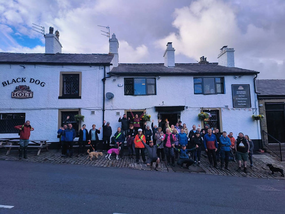
📍 Black Dog, Church St, Belmont, Bolton, BL7 8AB - bachelor.lentil.adjuster - SD674158.
🚌 There is NO PUBLIC TRANSPORT available to this location in the evening.
🚗 The pub has a large car park BUT car pooling is encouraged where possible so as not to hog spaces for other customers and diners. If parking around the village, please take care not to block access for local residents and businesses, ALWAYS check signage before leaving your vehicle.